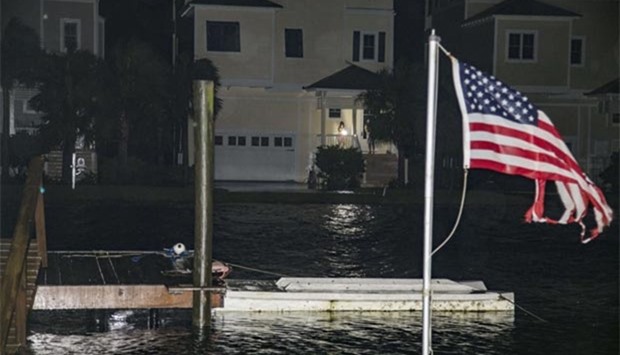
Hurricane Hermine swept onto Florida's Gulf coast early Friday with winds and heavy rain causing flooding and cutting power to tens of thousands of people, with officials warning of "life threatening" conditions.
The Category One storm made landfall around 1:30 am local time near St Marks, just south of Florida's capital Tallahassee, with 80 mile (130 kilometer) per hour winds extending 45 miles from the hurricane's eye, the Miami-based National Hurricane Center (NHC) said.
"There is a danger of life-threatening inundation within the next 12 to 24 hours along the Gulf coast of Florida," it added.
The storm is moving north-northeast at 14 miles per hour.
Some 70,000 people in rain-drenched Tallahassee were already without power as local television stations broadcast video footage of buffeting winds and cars driving through flooded streets.
Authorities in several counties have issued mandatory evacuation orders for residents living on the coast and in low-lying regions.
"This is life-threatening," Governor Rick Scott told journalists on Thursday, urging residents to take warnings seriously. "We have a hurricane. You can rebuild a home. You can rebuild property. You cannot rebuild a life."
Hundreds of schools and government offices will be closed on Friday as residents brace for the storm's full impact.
Hermine is the first hurricane to hit Florida in 11 years since Hurricane Wilma in 2005.
Pentagon spokesman Jeff Davis said 100 Florida National Guard personnel were activated, with 6,000 more on alert in the state and 34,000 members ready to deploy from elsewhere in the United States.
President Barack Obama has asked FEMA administrator Craig Fugate to keep him updated on the situation "and to alert him if there are any significant unmet needs", White House spokesman Josh Earnest said.
"Local, state and federal officials have been working diligently to prepare for these storms and have resources on hand to respond to them as necessary," he added.
Possible tornadoes
Less severe but still dangerous tropical storm-force winds are buffeting several hundred miles of Florida coast, from Tampa to the barrier islands south of Pensacola.
The ocean water surge could reach as high as nine feet (three metres) above normal levels, forecasters said.
"The combination of a dangerous storm surge and the tide will continue to cause normally dry areas near the coast to be flooded by rising waters moving inland from the shoreline," the NHC said.
Hermine is expected to drop a total of five to ten inches (12 to 25 cm) of rain over the southeastern United States from northwest Florida through southern and eastern Georgia into South Carolina and eastern North Carolina, with possible isolated maximum amounts of 15 inches, the NHC said.
"These rains may cause life-threatening floods and flash floods," it said.
Heavy rain could reach the Mid-Atlantic coast from Virginia to New Jersey beginning early Saturday, the NHC added.
Some tornadoes are possible overnight Thursday across northern Florida and southern Georgia, with the risk spreading across the eastern Carolinas on Friday.
Farther north, Georgia has declared a state of emergency in 56 counties, and North Carolina in 33 counties.
The last hurricane to make landfall in the United States was Hurricane Arthur in 2014 in North Carolina.

People come out to inspect the damage as the eye of Hurricane Hermine passes overhead in the early hours Friday in Shell Point Beach, Florida.
