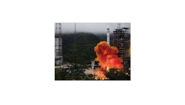
China yesterday launched the final satellite in its homegrown geolocation system, completing a network designed to rival American GPS as it jostles for market share in the lucrative sector.
Footage broadcast live on television showed a rocket blasting off with the satellite from a mountainous region of southwest China, which state media hailed as another milestone in the country’s space programme.
The Beidou system – named after the Chinese term for the Big Dipper constellation – works on a network of about 30 satellites and competes with the US’s Global Positioning System (GPS), Russia’s GLONASS and the European Union’s Galileo. “I think the Beidou-3 system being operational is a big event,” Jonathan McDowell, an astronomer at the Harvard-Smithsonian Center for Astrophysics, said. “This is a big investment from China and makes China independent of US and European systems.”
The final satellite, the Beidou-3GEO3, will help improve the network’s accuracy. China started building the system in the early 1990s to help cars, fishing boats and military tankers navigate using mapping data from the country’s own satellites. Now the service can be used on millions of mobile phones to find nearby restaurants, petrol stations or cinemas, and to guide taxis.
In 2012, Beidou’s coverage entered commercial use in the Asia-Pacific region, becoming available worldwide in 2018. Around 120 countries, including Pakistan and Thailand, use the services for port traffic monitoring, guiding post-disaster rescue operations and other uses, according to Chinese state media. Beijing is counting on its trillion-dollar Belt and Road global infrastructure project to convince other countries to use its technology as it attempts to grab market share from GPS.
China’s geolocation services market is expected to be worth 400bn yuan ($56.4bn) in this year, a senior official told state media.
The global geolocation services market will be worth $146.4bn by 2025, according to San Francisco-based Grand View Research.
Analysts said Beidou was already outperforming GPS in terms of accuracy, but it still had a long way to go before overtaking its American rival as the world’s dominant geolocation system.
McDowell said he did not think Beidou would be able to “supplant GPS in the next 10 or even 20 years.” Carter Palmer, a space systems analyst at US-based consultancy Forecast International, said there were still questions over Beidou’s reliability but its accuracy was a big selling point. “What I do see is (users) using multiple systems, including Beidou, to have more accurate satellite navigation,” he said.
The completion of the Beidou network will also be of benefit to China’s military. China has poured about $10bn into the Beidou system, to keep the communication networks of the country’s military secure and avoid the risk of disruption. “Technically, Beidou is capable of replacing GPS, for example in wartime if the United States cuts off access to GPS in China,” said Chen Lan, an analyst specialising in the Chinese space programme. China’s military also uses it to guide missiles and fly drones.

A Long March-3B carrier rocket carrying the Beidou-3 satellite, the last satellite of China’s Beidou Navigation Satellite System, takes off from Xichang Satellite Launch Center in Sichuan province, China yesterday.
